Philip Paar has been recognized as a geo design, Grassroots GIS, and landscape visualization enthusiast. In 2010, he started an ongoing affair with the digital content creation industry. Autodesk 3ds Max® users of this Blog are invited to check out the Laubwerk Plants Kits Freebie for free trial at laubwerk.com.
Author: Philip Paar

A rare peek on how Google build maps
An exclusive look inside Ground Truth, the secretive program to build the world's best accurate maps by Alexis C. Madrigal, enior editor at The Atlantic.
http://www.theatlantic.com/technology/archive/2012/09/how-google-builds-its-maps-and-what-it-means-for-the-future-of-everything/261913/
(Thank you Maning Sambale for sharing)

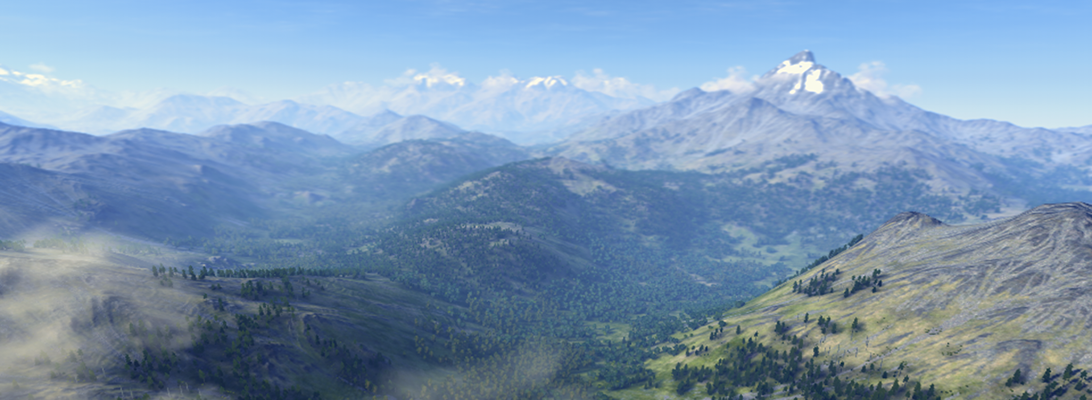
Future Internet, Special Issue Landscape
The Open Access journal Future Internet has just published interesting papers from LVIZ authors Olaf Schroth et al. and Philip Paar (with Jörg Rekittke):
Bright (GIS) Future for CityEngine
On July 11, 2011, Esri has announced the acquisition of Procedural Inc, Zurich.
Years after the nifty but discontinued attempts of the SketchUp 6 / ArcGIS 9.2 Plug-in, ESRI takes the gloves off and finally makes a true jump into 3D cities modeling, planning and design. And finally GIS meets Games Design and vice versa. The rule-based approach of CityEngine apparently tasted right to Esri.
Read the press release.
Here are FAQs for CityEngine customers. Personally, I like the Question “Who is Esri and Jack Dangermond” the most. FYI, Procedural customers: Jack is one of the most interesting personalities I have met and he has a memory for faces and names of several petabytes.
I find it very interesting how Esri’s GeoDesign strategy and the CityEngine technology will merge.
Addendum: Esri Adds 3D Design Tools with Procedural Acquisition by Matt Ball
Street Slide – Street View a la Microsoft
Digital Urban highlights a Microsoft SIGGRAPH paper and patent that present an advanced Street View like technology, which combines the immersive nature of 360° Panoramas with the overview provided by multiperspective strip panoramas. The video also demonstrates the almost seamless transition between the panoramas.
Play the CityOne Game
IBM has launched CityOne, a serious game that aims to raise awareness, and help address some of the challenges and solutions for building a smarter city.

Almost unnoticed: Bing Maps 3D is dead
I was trying to re-visit the SpeedTree trees in Bing Maps 3D, but strangely the 3D interface of Bing Maps has disappeared. Then I found this announcement on Bing Maps Blog.
Many comments express their concerns about the discontinuation of the 3D control, SDK licensees seemed totally surprised that 3D control is discontinued without a replacement or replacement announcement. Has Mircosoft given up to compete with Google Earth?
3D Trees in GE, it is a feature not a bug
If you can’t see the tree layer and your Google Earth user interface is other than English, change the language to US English and the Trees show up in the 3D buildings options http://earth.google.com/support/bin/static.py?page=guide.cs&guide=22358&topic=22360&answer=148181
Review of GE 3D Trees
I have been expecting 3D trees in Google Earth for years. I am just surprised that the 3D trees look relatively ugly (1990ies computer graphics). But it is indeed a step towards landscape visualization.
In fall 2008, Microsoft’s globe formally known as “Virtual Earth” got some nicer 3D trees from SpeedTree. But they only included a few cities such as parts of Miami.
Paar and Clasen (2007) describe a landscape scenery globe focusing on complex 3D vegetation cover, including shrub, grass and herb layers.
Currently, in GE 6, there are some misplaced trees (not there in reality or placed in the middle of roads). I am wondering when Google will add tools to SketchUp and GE for planting trees. Then I guess users will ask how to distribute larger areas of plants. This is was ArcGIS users and Biosphere3D users have always been asking us.
Autodesk // Labs_ Project Galileo
Project Galileo will be previewed at Autodesk University, Dec 1st, 2010. Galileo is an easy-to-use planning tool for creating 3D city models from civil, geospatial and building data, and 3D models. Galileo also enables users to sketch conceptual infrastructure ideas within the 3D city model. Using Galileo, planners, GIS analysts, project managers, and architects can help stakeholders better understand infrastructure projects and plans in the context of the built and natural environment.
Check: http://atlandsend.typepad.com/at-lands-end/
Is it based on the LandXplorer framework?