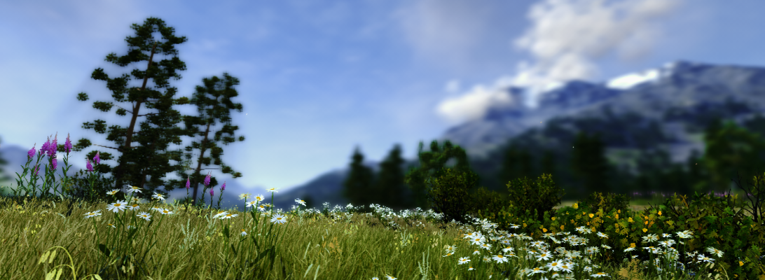
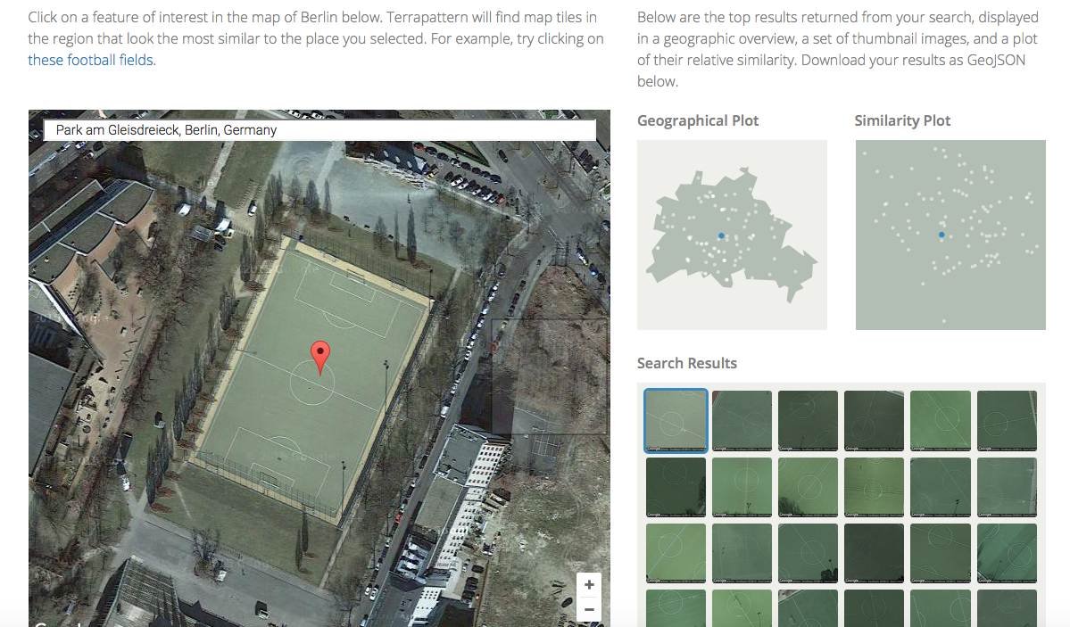
Terrapattern is an amazing research project originated at the University of Pittsburgh providing a visual search tools for the analysis of satellite imagery. Until now, such tools have only been accessible to intelligence services.
Terrapattern: Football pitches in the Berlin case study
The search engine behind Terrapattern is based on an Artificial Intelligence (AI) and will learn, i.e.g improve, over time. You can for example select a church and then, Terrapattern will show all visually similar objects. For now, Terrapattern is only available for selected case studies, ie. Pittsburgh, San Francisco, New York, Detroit, Miami and Berlin!
Apart from the various commercial uses for such a visual search tool, I am excited about the potential for landscape studies. At the tip of a mouse click, Terrapattern will produce a typology of open space forms. You could search for playgrounds, cemetries or specific vegetation patterns! As soon as the tool is available outside of a few selected cities, it could also be used to describe different landscape types, e.g. in landscape character assessment, and make distinct landscape patterns visible.
The PhD is closley linked to the Improving Wellbeing through Urban Nature project
Funding has become available for a PhD, which will investigate whether a smartphone App can encourage people to spend time outdoors.
The PhD, Can a smartphone App promote therapeutic interactions with the natural environment? is closely linked to the three-year Improving Wellbeing through Urban Nature research project, which is being led by the University of Sheffield’s Department of Landscape.
The successful applicant will support the development of a smartphone App, evaluate the efficacy of the App as a data collection tool and work closely with project partners to explore the potential for the App as a green prescription.
Based on data collection via the smartphone App, the project aims to answer the following research questions:
• Which types of urban natural environments are most effective in delivering health and wellbeing benefits?
• What level of exposure to natural environments (duration) brings about benefits in health and wellbeing?
• How does quality of experience in nature impact on he benefits?
• How do individual differences and demographics mediate health and wellbeing benefits?
• What are the differing impacts of natural environment exposure on mental health service users and non-users?
Applicants should have minimum of a 2:1 first degree in a relevant discipline/subject area or a Masters in a relevant discipline/subject area. Applications are open to UK, EU and international students but University fees will only be waived up to the UK/EU maximum. A stipend starting at £14,296 and rising in line with RCUK rates will be awarded annually.
Das Leibniz-Institut für Länderkunde (IfL) in Leipzig sucht zum 1. September 2016 eine(n)
Postdoctorand in Geospatial Visualisierung
(1,0 TV-LE13, befristet bis zu vier Jahren)
zur Mitarbeit in bestehenden Forschungsprojekten und zur Entwicklung neuer Visualisierungs- möglichkeiten im Rahmen von digitalen und gedruckten Atlanten und weiteren Institutspublikationen des IfL. Die Mitarbeit unterstützt Forschungs- und Transferprojekte, die Ansätze der Geographie, Informationswissenschaften, Computerwissenschaften und Kartographie verknüpfen. Bevorzugt werden Kandidaten mit Forschungsinteressen in innovativen Formen der Raum-Zeit-Visualisierung, kulturellen Dimensionen der Visualisierung und Geovisualisierung mit neuen Medien.
The Department of Landscape Architecture and Spatial Planning (ILP) at the Norwegian University of Life Sciences (NMBU) is announcing a 3 year PhD fellowship position for a qualified candidate in the topic: “The role of 3D visualization technology in testing environmental perceptions in the context of landscape design and urban planning processes”. 3D and visualization methods have yet to harness their full potential as research methods for testing the reactions and perceptions of users to particular environmental conditions and qualities that favour livability in various urban design contexts. Much environmental psychology research occurs either in the field, through audits and site observations, or in a laboratory, relying mainly on pictures or other static forms of landscape representations. 3D technology has yet to be used to bridge the gap between laboratory and real-life experience, and would allow us to collect data across a variety of geographical contexts, and without the need for expensive site visits for all subjects.
This PhD project would strengthen research on digital applications in landscape architecture and urban planning. The aim is to explore the potentials and challenges associated with 3D digital tools and visualizations when applied in the areas of urban design, urban systems planning, landscape design. The research will make use of a collaborative research environment at ILP by cooperating with other researchers and sections. In addition, the VR-Lab will be used as arena to facilitate the research work experimentation with new technologies in sharing knowledge, increasing interdisciplinary collaboration, and engaging users.
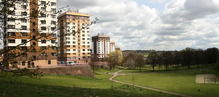
taken in Weston Bank Park Sheffield (UK) January 2016
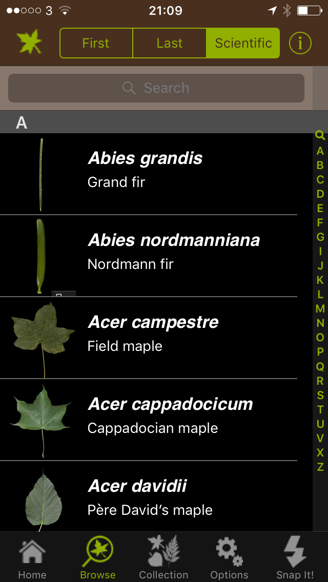
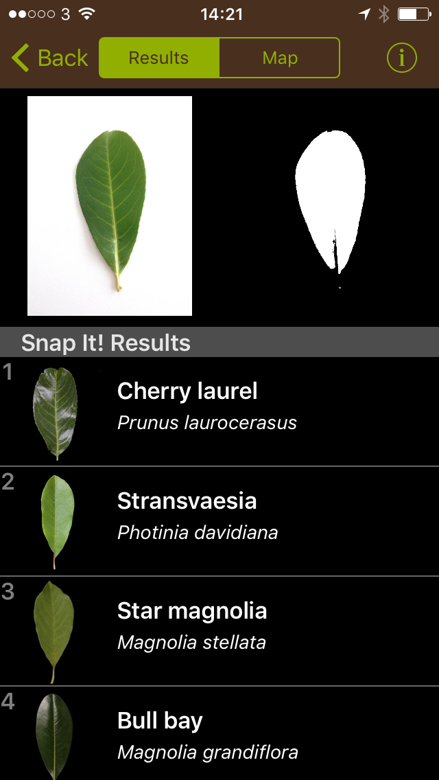
How long have we all dreamed of an app that could provide us automatically with reliable plant id? Well, Leafsnap UK may not fully get there but it is already a huge step ahead. Leafsnap UK uses visual recognition software to identify tree species from photos of their leaves. Its leaf recognition technology (think of face recognition but for trees) was developed by the US Leafsnap teams at Columbia University, University of Maryland and the Smithsonian Institution. The Natural History Museum in London and the botanists working at the Angela Marmont Centre for UK Biodiversity ensured the accurate adaptation of British tree species.
In order to identify a tree, you first have to photograph a leaf on a white background. Then, Leafsnap will suggest tree species with similar leafs to you. Now confirm the tree’s identity by checking the suggested images and text for matches. In a quick test in Weston Bank Park in Sheffield (UK), I still had to choose between 25 different species. However, that was already much quicker than other plant id apps, which are basically electronic versions of plant id books and where you have to go through the whole id process manually. An Android version is planned at the time of this post.
Leafsnap is available for free, but currently for iOS only in the AppStore
Crytek, a company famous for its first person computer games with vast landscape areas in cutting edge visual quality, has launched the VR First Initiative. Objective of the initiative is to support universities around the globe in launching Virtual Reality (VR) labs, where the next generation of computer programmers and designers can practice.
I’ve been involved in a couple of visualisation labs at European and Canadian universities and it was always the biggest challenge to manage and update the hardware over time. When the first Oculus Rift came out, I already wondered whether we could replace resource intense facilities such as visualisation domes (360º projection domes) with rather affordable and easy to update VR glasses. It looks as if Crytek is implementing this approach on an interconnected global scale now and with their knowledge in visualisation, this will be a most interesting initiative to watch.
It has been 50 years since the White House Conference on Natural Beauty took a hard look at the state of scenic America. What has happened to this country’s scenic assets since then?
In an interview with ASLA, Dr. James Palmer, is looking back on the assessment of scenic quality in the US and summarizing today’s state of research. At the end of the research, he is finally giving an outlook where future research should go.
Special issue released: The April 2015 issue of Environmental Impact Assessment Review, edited by Lorenz Hilty and Bernd Page, provides an overview of ICT-based approaches to facilitate the assessment of renewable energy solutions.
Recent advances in landscape visualization have dramatically increased our ability to portray past, present, and future conditions across a range of scales from site to region, altering the ways in which people perceive their environments and influencing changes in social and cultural practices. While landscape architects and planners have long employed representational methods, the proliferation of new digital technologies for visualization is rapidly outpacing the theoretical grounding needed to meaningfully guide design and planning outcomes. This special issue attempts to bridge this practice–theory gap by bringing together diverse contemporary practices, methods, and theoretical perspectives in order to build a shared understanding of the relationships between visualization techniques and the knowledge they produce.
*** The full issue is open access until Nov. 20 ***
Special Issue: Critical Approaches to Landscape Visualization
Edited by Katherine Foo, Emily Gallagher, Ian Bishop and Annette M. Kim
Landscape and Urban Planning, Volume 142, Pages 1-244, October 2015