With quite some delay, a short recap of this year’s Digital Landscape Architecture Conference DLA 2015. After the brilliant DLA 2014 conference abroad, this year’s conference took place in its home town of Dessau again (before it will move to Istanbul for 2016).
The first key note was delivered by Prof. Brian Orland from PennState and at the time, visiting Weddle Chair at the University of Sheffield: “Geodesign – The Family Car of GIS“. The main argument was that geodesign is still a black box but stakeholders need to participate in telling the story. As key stones Brian suggested the following three elements and illustrated them with the example of hydraulic fracturing:
– Storytelling
– System Exploration
– Group Interactions
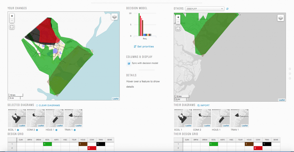
Another highlight of the conference were the presentation by Prof. Carl Steinitz and colleagues of the “Coastal Georgia 2050 Geodesign Synthesis Workshop” and the hands-on workshop “Digital Workflow for a Dynamic Geodsign System” delivered by Hrishikesh Ballel, PhD student of Prof. Carl Steinitz. The tool can be tested under http://www.geodesignstudy.com/
Prof. Stephen Ervin further pushed forward the theoretical framework of Geodesign: “A Proposed Map of a Geodesign Research Map.”
For these and further presentations and workshops at the DLA2015 Conference, please see the peer-reviewed conference proceedings published by Wichmann:
Peer-reviewed conference proceedings DLA2015

