Last week, I had the chance to see Doug Eberhard, Senior Director of Autocad and head of the Digital Cities Initiative, speaking at the conference “The new dimension in GIS – 3D Analysis“, hosted by the British Columbia section of URISA. His focus were 3D city models and he promoted their future not only for visualization but also for analysis. According to him, the process and people behind need to catch up with the technology, i.e., processes and methods are needed for a collaborative workflow. All these issues are explored in the Digital Cities case studies with Seoul and Salzburg being the first two.
Interestingly, Mr. Eberhard showed lots of examples from LandXplorer (though without mentioning the name of the product) and gave a lot of credits “to the Germans”. Furthermore, he highlighted that CityGML and its interface ADE allow to incorporate extensions for analyses and that has huge potential from his point of view.
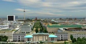
LandXplorer screenshort of Berlin (source: http://www.3dgeo.de)
Apparently, Autocad is promoting LandXplorer and CityGML now, which I find very encouraging. You can download an abstract of Mr. Eberhard’s talk at http://www.urisabc.org/assets/events/2009/3D/bios_abstracts/digitalcities.htm and if you like to see another presentation by Doug Eberhard, he will be at AGIT (Salzburg) as well as Geoweb (Vancouver).

