I am wondering if we should include the topic of virtual 3d city models or – as they are called lately – digital cities in our blog. After some considerations I think that we should include this topic for two main reasons.
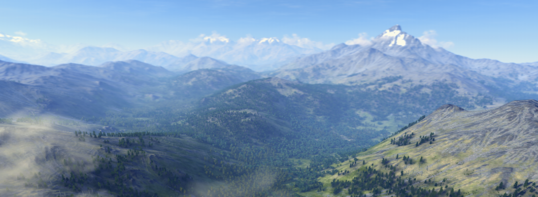
First of all the authors of this blog come from research in landscape and environmental planning and we tend to have an all-embracing understanding of landscape. This means that the word ‘landscape’ is an concept which includes topography, vegetation and wildlife, land-use, housing, climate, etc.. In this all-embracing concept cities are part of the landscapes around us.
Secondly we do not do landscape visualization just for the fun of visualizing a landscape, but because we think that landscape visualizations can support planning descisions and communication processes in planning processes. Thus we have an aim, a goal why we visualize and this goal is the driver for visualizing rural landscapes, as well as suburban landscapes or cityscapes. I think that we will benefit if we are looking at concepts from landscape and city visualization/modelling at the same time and relate the visualization concepts to the underlying planning tasks.
Another reason to include digital cities from my point of view is that I am currently working on a project which deals with virtual 3d city models and visualization of the cityscape. The project is funded by the Federal Ministry of Education and Research, Germany and deals with the usability to support communication and information in urban land management by using virtual 3d city models as integration media for heterogeneous data. For more information hava a look at www.refina3d.de. (only in German)
From my point of view, I support the inclusion of 3d city models in this blog. Going even further, I’d suggest to include virtual globes as well because both tools are very potential in landscape visualization. However, posts on both topics should have a focus on the representation of landscape in order to distinguish this blog from the various existing blogs on 3d city models, Google Earth etc.
Stephen Sheppard suggested that we should formulate a mission statement for the blog and I think, this discussion is an important first step to the setup of such a mission statement.
I agree to your idea of including virtual globes and I support Stephen Sheppards suggestion to formulate a mission statement. But I am not sure, if I understand what you mean when your are talking about having “a focus on the representation of landscape”. Do you mean to focus on methods for modelling and visualizing natural elements such as terrain, vegetation and atmosphere? To my opinion this would be a too narrow focus. As I wrote in my post I look at cities as being integral part of the landscape and I think a landscape is defined by the natural resources as well as by the influence and activities of mankind. I also think that the strict distinction into urban planning and landscape planning, or to be more general: into different planning disciplines, which focus only on their part of the landscape, is counter-productive in the context of sustainability. I think that one of the major challenge is to get other these disciplinary barriers and to create virtual globes/virtual cities/virtual landscapes, which are scale and application independent and can be augmented on demand.
Another comment I’d like to add relates to your saying that globes/virtual cities ‘are very potential in landscape visualization’. It brought me to the point to ask myself what is ‘landscape visualization’? Can this term be defined? We tend to use it from our points of view and we relate it to applications which use virtual mirrors of real landscapes to put scenario information or planning proposal inside. But there might be total different ideas what landscape visualization is and what it is good for. I think this might be another discussion point.
I completely agree that we need a wider conception of our environment and therefore, we have to go beyond the narrow boarders of specific disciplines as there are architecture, urban design or landscape planning. Especially with regard to the city, I don’t want a strict distinction either but ideally, professionals from all disciplines that deal with the landscape, including architecture, urban and landscape planners, geographers, surveyors, politicians, economists, social scientists and many others are welcome to use this blog as a platform to talk about landscape visualization.
However, by suggesting the focus on the representation of landscape, I did mean the methods for modelling and visualizing the natural as well as the man-made elements. Though this should only be the focus of this blog in contrast to other blogs out there. It’s by no means exclusive and discussions on planning theory for example, any aspects of sustainability, are welcome, too. Landscape visualization in a narrow sense does only provide the red thread.
There is no universal definition of “landscape visualization” – so, we have to give ourselves a preliminary definition to work with. My suggestion would be that in contrast to traditional visualization methods, such as sketching or photomanipulation, this blog refers to computer-generated landscape visualizations. These are based on geodata and represent the visual landscape in 3D perspective views and with varying degrees of realism. The presentation of landscape visualizations can be static or dynamic, on different levels of interactivity and on immersive or non-immersive displays (cf. literature by Sheppard and Salter 2004; Bishop and Lange 2005).