This web portal on terrain modelling has been created at Forest and Landscape, University of Copenhagen by landscape architects José Lameiras and Ian Jørgensen. Both have a background teaching IT in landscape architecture. Focus is on digital technologies to interact with surface models and develop landscape design. So, this is about LIM – Landscape Information Modelling as a response to architect’s BIM (Building IM).
LVIZ wishes you a Happy New Year !
What will 2009 bring? Plans for the LVIZ blog include a detailed review of the new VNS3 and an overview of landscape visualization labs at universities around the world. Furthermore, the LVIZ blog community will formulate a mission statement, further develop its design and provide download resources for landscape visualization.
See you in 2009!
Vue 7 by e-on software released
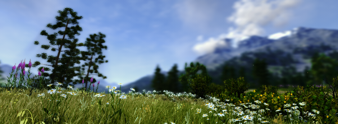
E-on software has released a new version of their landscape modelling and visualization software vue. According to the offical feature list a number of key methods and technologies have been improved significantly. Amongst the features are ecosystem models, volumetric clouds, tree generation, global ilumination, etc.
A look inside their gallery shows some very detailed and realistic scenes, e.g. the Picture of the Day, Wednesday, December 10, 2008.

I have made some tests with an earlier Version in 2004 and I have to say that it was a lot of fun to work with vue. The main problem was to integrate GIS data and to create realisitc plant distributions. I wonder if this has changed by now, because the visual quality which can be achieved is very impressive.
Low Carbon Cities
45th ISOCARP International Congress
Porto – Portugal, 18-22 October 2009
www.isocarp.org
Porto – Portugal, 18-22 October 2009
www.isocarp.org
“For our 2009 congress in Porto, we focus upon the environmental effects of man’s activities, in the context of the world’s expanding cities and city regions.
It is those cities and agglomerations that are undoubtedly the source of a large share of the greenhouse gas emissions that underlie climate change; at the same time, these are the places that are often the most vulnerable to its effects.
Time is short and if we are to avoid the worst effects of anthropogenic climate change, we must act and act quickly.
The challenge is to use (and reuse) our resources, including land, far more efficiently and, in particular, to move towards low carbon cities.”
(Chris Gossop – General Rapporteur)
AGIT 2009 Call for Papers out now
AGIT 2009 is a well established GIS conference in Salzburg with one track on visualization and cartographic communication. For more information, please refer to www.agit.at
Visioning and Visualization: People, Pixels, and Plans
The Planetizen Top10 book list for 2009 suggests a very interesting book on participation and visualization:

Visioning and Visualization: People, Pixels, and Plans
- Authors: Michael Kwartler and Gianni Longo
- Publisher: Lincoln Institute of Land Policy (April 30, 2008)
- Language: English
- ISBN-10: 1558441808
- ISBN-13: 978-1558441804
If anybody has read the book already, please contribute your review to this blog. Otherwise, I will provide you a review as soon as possible.
Job opening at the Macaulay Institute Aberdeen
The Macaulay Institute in Aberdeen is currently seeking a landscape and visualisation modeller and a spatial planner. For further information, please refer to
http://www.macaulay.ac.uk/jobs/
Sketchup 7 is out now
According to Google, the new publisher of Sketchup, version 7 is out now (Source: Official Google Blog). Among the various new features, the possiblity to assign dynamic behaviour and attributes (only the Pro version) seems particularly interesting to me. In consequence, the construction of semantic models with Sketchup is getting another step closer.
Upcoming conferences: CORP, Imagina
REAL CORP 2009
As Manfred Schrenk already had announced at the end of this year’s REAL CORP, the 14th International Conference on Urban Planning and Regional Development in the Information Society, won’t take place in Vienna but in the Design Centre Sitges, Spain. The Call for Papers is open now and details are available at http://www.corp.at/
IMAGINA
The Imagina is an event, focussing on the 3D visualization community in industry, architecture, media and entertainment. This year’s imagina could become interesting for researchers in urban and landscape planning as well because it focuses on the use of 3D in town and country planning. Among the speakers are officials from cities like Manchester, using 3D visualization already, and Prof. Dr. Thomas Kolbe, who will present on CityGML.
More information is available at http://www.imagina.mc/
Autodesk buys 3D Geo (LandXplorer)
In August Autodesk already published a press release, announcing that they buy the German company 3D Geo, a spin-off of the Hasso-Plattner Institute in Potsdam that became well-known for their LandXplorer software. LandXplorer is basically an authoring system for 3D geodata that allows to construct, analyze, store and manage 3D city models for various export formats (GeoBrowser, VirtualReality, GameEngines, WebApplications). Among other features, LandXplorer is one of the first software packages to support CityGML. The full text is available at http://www.3dgeo.de/news.aspx?Article=143
Autodesk said that they will keep the office in Potsdam as future development center in Europe and that they will further develop LandXplorer. This might even open a chance that LandXplorer will become a meta-platform to link single Building Information Models on a larger scale, i.e., as part of a semantic 3D city model.