Vancouver becomes the third city of Autodesk’s Digital Cities Initiative

The more regular readers of this blog might remember the article on the last URISA symposium. It seems that the conference has been the origin of a closer collaboration between the City of Vancouver and Autodesk, who now announced Vancouver to be the third city of the Autodesk Digital Cities Initiative (click here for the official press release).

The first two partners of the initiative have been Salzburg, Austria and Incheon, Korea. With Vancouver, Autodesk has chosen the first pilot city in Northern America and it seems to be a win-win situation to me:

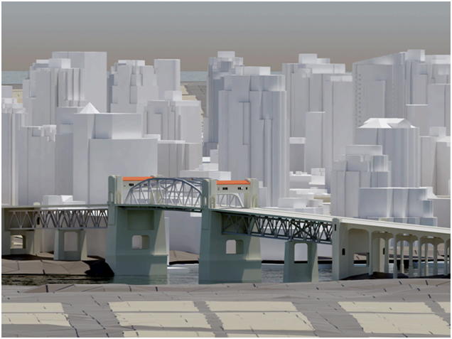
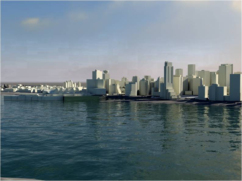
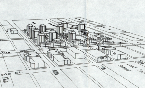
As you can see in the first image, which dates back to 1980, Vancouver has always been at the forefront of using 3d city models in planning and its planners are “early adopters”, open to innovative digital technology. Today, a lot of 2d and 3d data is available and stored in an Oracle spatial database. The only tool missing was an open platform to bring the different standards from CAD to BIM and GIS together and here, Autodesk’s new CityGML-based products fit very well.

For Autodesk, Vancouver is an interesting use case because the city has a high growth rate (2000-2005: 5.6 %) and a lot of development has taken place over the last years. Despite the current economic crisis, Vancouver is undergoing another boost and will gain additional international attention because of the Winter Olympics 2010.

The high growth rate and the demands of the Olympic Game impose a lot of urgent issues to the planning department. According to city planner Dan Campbell’s presentation at the URISA conference, the planning department is looking for new ways to complement the use of its 3d city model for visualization by additional analyses:

According to Dan Campbell, the partnership with Autodesk’s Digital Cities Initiative has the potential to facilitate public participation in planning and to enable sustainable design. An “intelligent” and also attractive 3d city model can make it easier for people to understand planning issues and can capture visual and emotional aspects better than traditional tools.

Images: Dan Campbell: City of Vancouver 3D, Presentation at the URISA symposium “The new dimension in gis – 3D analysis” January 22, 2009, Burnaby.
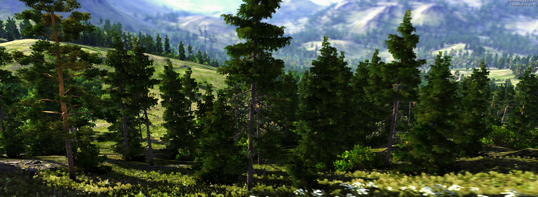
CityScape 1.6 by PixelActive

A workmate has drawn my attention to a new tool for constructing 3d city models: CityScape 1.6 by PixelActive. Although I had no time to try the demo yet, it seems to me that the included models fit best for cities in Norther America. The supported file formats include elevation data and Collada, which makes it interesting for city planners, too. Another interesting feature is the real-time animation. However, my guess is that it is most useful for game designers.

Open Source Toolkit for 3D Plant Modelling

Yesterday I came across an articel in Graphical Models (71), pp. 1-21. It is about PlantGL, an open-source graphic toolkit for the creation, simulation and analysis of 3D virtual plants. The software is based on three components: a geometric, an algorithmic and a GUI library with an interface to Phyton, which enables a modeller to develop scripts and procedures in Python. Furthermore, importers and exporters for data exchange with several modelling and visualization systems, such as AMAPmod/VPlants and Pov-Ray, exist. The approach combines several methods to represent plant structures at different scales, ranging from tissues to plant communities. One of the features are parametric envelopes for the representation of crown shapes, which sounds to be a very promising technique to control the shape of 3D plant models. Accurate representation of the crown shape will be important for representing plants in real world models (e.g. 3D city models) for visibility analysis.

According to the paper the librarys seem to be very powerful and several examples are presented reaching from 2D and 3D tissue models to branching systems and plant communities. Moreover, a quick overview over current plant modelling approaches is given including L-Studio/Vlab and GroGra based on L-systems, the AMAP system, and Xfrog and extensive references to related work are given. Thus I like to encourage everybody interested in plant and vegetation modelling to read the paper and look at the website of the Virtual Plant project team. The site shows several examples, links to research papers and software, and explains the methods apllied in the research.

Doug Eberhard (Autodesk) promoting CityGML

Last week, I had the chance to see Doug Eberhard, Senior Director of Autocad and head of the Digital Cities Initiative, speaking at the conference “The new dimension in GIS – 3D Analysis“, hosted by the British Columbia section of URISA. His focus were 3D city models and he promoted their future not only for visualization but also for analysis. According to him, the process and people behind need to catch up with the technology, i.e., processes and methods are needed for a collaborative workflow. All these issues are explored in the Digital Cities case studies with Seoul and Salzburg being the first two.

Interestingly, Mr. Eberhard showed lots of examples from LandXplorer (though without mentioning the name of the product) and gave a lot of credits “to the Germans”. Furthermore, he highlighted that CityGML and its interface ADE allow to incorporate extensions for analyses and that has huge potential from his point of view.

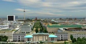
LandXplorer screenshort of Berlin (source: http://www.3dgeo.de)

Apparently, Autocad is promoting LandXplorer and CityGML now, which I find very encouraging. You can download an abstract of Mr. Eberhard’s talk at http://www.urisabc.org/assets/events/2009/3D/bios_abstracts/digitalcities.htm and if you like to see another presentation by Doug Eberhard, he will be at AGIT (Salzburg) as well as Geoweb (Vancouver).

First Open Source GIS UK Conference

Date: June 22, 2009

Location: University of Nottingham, UK

Website: www.opensourcegis.org.uk

GEOIDE Annual Scientific Conference

Date: May 27-29, 2009

Venue: Vancouver Marriott Pi­­­nnacle Downtown Hotel

Location: Vancouver, BC

Website: www.geoide.ulaval.ca/conf09/main.asp

GoogleEarth 5.0: 20000 Miles Under The Sea

The new version of GoogleEarth, which can be downloaded now, has been extended by the underwater landscape of the Earth – which is two third of the Earth’s surface… Furthermore, the function for setting up your own tours has been improved and the time-travel function has become standard. Now, it will be really interesting to use GoogleEarth to show landscape development over time, historic and into the future. Oh, and finally, they added the Mars. For a more detailed summary of the new functions in German, see the Der Google Produkt-Kompass: Reise unter die Meeresoberfläche mit Google Earth 5.0 or Youtube (English):

AGILE 2009 Hanover

AGILE – Call for extended abstract

Cross Atlantic Workshop on Economic Value of Geoinformation – GeoValue ‘09

Date:  June 2-5, 2009

Location:  Hannover, Germany

The 12th AGILE International Conference on Geographic Information Science will be hosted by the City of Hanover and organized by the Institute of Cartography and Geoinformatics of the University of Hanover.

Conference Topics

Contributions are invited on all topics within the fields of geo-information, geomatics, geocomputation and remote sensing and image interpretation, including (but not limited to):

  • Geospatial Data Capture, Fusion and Harmonisation
  • Discovery and Retrieval of GI
  • Semantics of GI
  • Spatial Information Infrastructures
  • Location Based Services and Mobile Applications
  • Demographic and Socioeconomic Modelling
  • Environmental/Ecological and Urban/Regional Modelling
  • Health and Medical Informatics
  • Natural Resources Management and Monitoring
  • Disaster and Risk Management
  • Spatial Decision Support
  • Spatial Data Usability and Data Quality
  • Spatiotemporal Modelling and Analysis
  • Spatial Cognition
  • Geosensor Networks
  • Visual Analytics and Geovisualisation
  • GI Education and Training
  • GI Policy and Society, e-Government

Special Topics Related to Remote Sensing and Image Interpretation

  • Earth Observation Systems: Issues and Applications
  • Lidar Processing Algorithms and Applications
  • Image Interpretation for Topographic Mapping
  • Image Analysis for Change Detection

There are also several workshops, among them the “Cross Atlantic Workshop on Economic Value of Geoinformation”. Please have a look at the call for papers for this workshop as well: agile-workshop geovalue-09

ISSRM 2009

15th International Symposium on Society and Resource Management
Meet old and new worlds in Research, Planning, and Management

The 15th International Symposium on Society and Resource Management will be hosted by The University of Natural Resources and Applied Life Sciences (BOKU) from July 5 – 8, 2009 in Vienna, Austria.

The symposium will be held at the Austria Center Vienna, the largest conference centre in Austria.

The theme for the ISSRM 2009 is:

Meet Old and New Worlds in Research, Planning and Management

– Discussing methodological traditions versus pragmatic solutions
– Exploring cultural and political influences on planning and decision making processes
– Feeling the transdisciplinary and transboundary character of research and management

The topics for the symposium include:

  • Outdoor recreation
  • Nature-based tourism
  • Sustainable tourism development
  • Climate change adaptation and mitigation
  • Management and development of protected areas
  • Social science and collaborative planning in forestry and agriculture
  • Innovative approaches to resource management
  • Wildlife management
  • Environmental education
  • Human behaviour and recreation research
  • Visitor monitoring
  • Landscape perception and preferences
  • Place attachment
  • Environmental Impact Assessment
  • Forest inventory and sustainable resource management
  • Water management
  • Cross-cultural cooperation and management
  • Collaborative landscape planning

Further information and abstract submission: http://www.issrm09.info/

Digital Landscape Architecture 2009

header

Abstracts not exceeding 250 words should be submitted online via a web-based submission system at
http://www.landschaftsinformatik.de by January 31, 2009,
for review and possible inclusion in the program.
The conference proceedings are published by Wichmann Verlag, Heidelberg.
The conference language is English.
The conference will be hold in Malta in order to address the regional focus of the conference on the Mediterranean Islands.

Keynote Speakers

Prof. Dr. Stephen Ervin, Harvard University, USA
Prof. Ian Jorgensen, University of Copenhagen, Denmark
Prof. Dr. Jürgen Döllner, Hasso Plattner Institute, University of Potsdam
Prof. Dr. Jörg Schaller, ESRI Germany
Prof. Dr. Marc Bonazountas, Epsilon, Greece
(other keynote speakers will be announced later)

Topics
The program committee cordially invites you to submit proposals for original,
unpublished presentations focusing on one of the following topics

A: Digital Landscape Design for the Mediterranean Islands
B: Landscape Information Models LIMs
C: 3D, 4D and VR Landscape Visualization
D: Teaching Digital Landscape Architecture /
E: Knowledge Based Landscape Architecture
F: 3D-Workmethod in Landscape Design

Important Dates

Abstracts due February 16, 2009
Notification of acceptance: February 28, 2009
Full manuscript draft due: March 23, 2009
Reviewed manuscript due: April 6, 2009
Conference: May 21 – 22, 2009

Further Information
Anhalt University of Applied Sciences, Hochschule Anhalt (FH)
Forschungsbereich Landschaftsinformatik, Prof. Erich Buhmann
INDIGO Innovationspark, Solbadstraße 2, D-06406 Bernburg, Germany
Telephone: +49-3471 -355-1116, Fax +49-3471-628179
conference proceedings: atelier.bernburg@t-online.de
conference organization: la@loel.hs-anhalt.de

Conference Scientific Director: Prof. Erich Buhmann
Submit Entries LA-Conferences at http://www.landschaftsinformatik.de

Conference partners:
AGIT2009, LE:NOTRE TW and partners in Malta

Conference sponsors:
ESRI Geoinformatik GmbH, SYNERGIS Informationssysteme GmbH, K2-Computer Softwareentwicklung GmbH a.o.