Large-Scale Multi-View 3D Reconstruction from Google Street-View Images

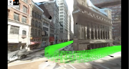
Get ready to be a part of the 3D map wars. While Google and Apple battle it out in creating complete 3D fully-textured models with their arsenal of impressive technological gadgetry, we could take part in our own personal skirmishes in generating 3D models of our own cities. Using sequential feature matching of images from street-view, generate 3D models through open-source image-based visualisation techniques. 

Michal Jancosek and his team from CMPMVS, a multi-view reconstruction software, experiments with large scale multi-view 3D reconstruction from Google Street-View Images. Fully automatic 3D reconstruction from 2424 600×800 images. Click here to view the video and go to http://ptak.felk.cvut.cz/sfmservice/ for more information.

Future Internet, Special Issue Landscape

The Open Access journal Future Internet  has just published interesting papers from LVIZ authors Olaf Schroth et al. and Philip Paar (with Jörg Rekittke):

Tool or Toy? Virtual Globes in Landscape Planning

Low-Cost Mapping and Publishing Methods for Landscape Architectural Analysis and Design in Slum-Upgrading Projects

Open Data for Berlin

The idea of Open Data is not new and scientists have promoted free exchange of data for a long time. However, the term Open Data refers to the recent trend in informatics and geospatial sciences to provide geographic data free to use. Pioneers were particularly in the UK, US and Canada, where it has traditionally been claim that government geodata should be free. Vancouver for example launched a rather decent Open Data website. This initiative created many possibilities for various new location based apps such as the very successful Vantrash that gives inhabitants of Vancouver the current schedule for recycling and garbage pick-up.

Now, Berlin as first major German city has set up a website with government Open Data under http://daten.berlin.de/datensaetze and it is to hope that this will trigger similarly successful geospatial applications.

Urban Network Analysis Toolbox for ArcGIS 10

The City Form Research Group at MIT has released a state-of-the-art toolbox for urban network analysis. It comes as ArcGIS 10 toolbox and can be used to compute five types of graph analysis measures on spatial networks: Reach; Gravity; Betweenness; Closeness; and Straightness. Due to a very tight time schedule this month, I had no time to test it yet but the Youtube video looks very promising and I would appreciate any reports from users.

Direct download link

Siggraph 2011 – Day 3

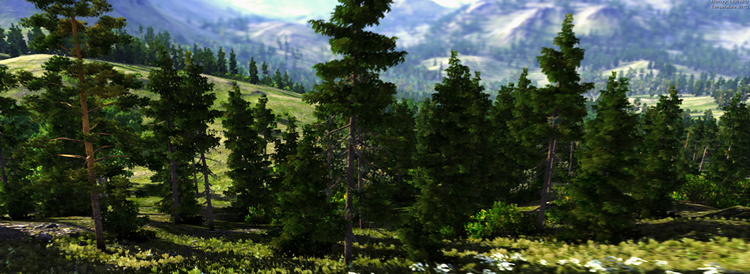
One of todays` highlights at SIGGRAPH 2011 in Vancouver was the approach of Prof. Deussen`s group in Konstanz and their partners at the universities in Shenzhen and Tel Aviv to use so-called “texture-lobes” for tree modelling from Lidar data. For more information, see http://graphics.uni-konstanz.de/publikationen/2011/texturelobesfortreemodeling/website/

Texture-Lobes for Tree Modelling from Soeren Pirk on Vimeo.

The afternoon was dedicated to urban modeling, starting with a review of the latest literature by Peter Wonka (Arizona State University) and Daniel Aliaga (Purdue University). During the second part of the session, Pascal Mueller from Procedural/ESRI (CityEngine) presented issues encountered in practice and their new Urban Vision project together with the urban planning department of San Francisco and Urban Sim (Paul Waddell). The session closed with a visually very engaging case study by Michael Frederickson from Pixar, using CityEngine for virtual London in Cars 2.

OpenStreetMap makes Bing!

OpenStreetMap (OSM) project founder Steve Coast has announced that he has joined Microsoft to work on its Bing Maps team. According to Coast, Microsoft will be providing access to its “global orthorectified aerial imagery to help OpenStreetMappers make the map even better than it already is”.

New Major Biosphere3D Release

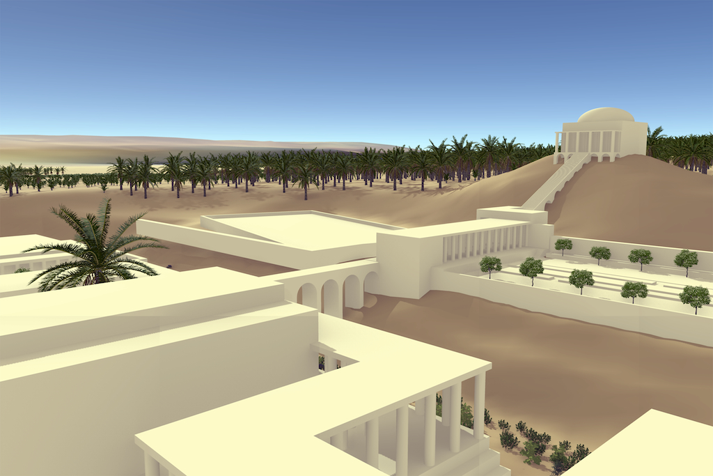
Biosphere3D rendering of Herod's 3rd winter palace and gardens

The new release of the free Landscape Scenery Globe Biosphere3D adds rendering effects such as ambient occlusion, shadow mapping and creation of camera paths and capture of animations.

New Biosphere3D logo by Henrik Andree

MapViewSVG renamed Mappetizer

The very useful GIS tool MapViewSVG has been renamed “Mappetizer“. According to the developer, the latest version Mappetizes 8.1 additionally has integrated support for OpenStreetMap (OSM) data (example). Yet, we didn´t have the opportunity to test this new functionality but considering our interest in open source solutions and especially geodata under creative common licenses such as OSM, we are curious about testing Mappetizer 8.1 as soon as possible.

Biosphere3D @ Sourceforge

Biosphere3D is now available at Sourceforge:

https://sourceforge.net/projects/biosphere3d/

3D city database for CityGML released

Virtual 3D city models are getting more complex, detailed, and increasingly large. Therefore, good solutions for the storage and the management of 3D city models are needed. Within this context we want to inform you that there is now a 3D database schema for the storage and management of CityGML-based 3D city models freely available, which can be implemented on top of Oracle 10G/11G. It also works with the Express version of both databases, which is free for use for educational and research purposes. The following is a rough translation of the German press release.

Press release, 27th April 2009.

The departement for Geodesy and Geoinformation Science, Berlin Institute of Technology, German has realesed free software tools for the management and storage of CityGML-based virtual 3D city models. The tools include a 3D database schema for the use with Oracle 10G R2 or 11G, an Importer/Exporter, and a Java class library for facilitating the work with CityGML. The package is released under the Lesser GNU Public License v3 and can be downloaded under the following URL: www.igg.tu-berlin.de/software. An English documentation is also available.

The CityGML-based 3D database was developed during the creation of the official 3D city model of Berlin and is successfully used for the storage and management of the city-wide virtual 3D city model. More information about the city model of Berlin as well as a Google Earth enabled version can be found under: www.virtual-berlin.de.