Procedural has joined ESRI’s Business Partner Program. Automatic creation and cloud-based visualization of photorealistic 3D cities from ArcGIS data with CityEngine and RealityServer. Presented on a Tegra Tablet at ESRI User Conference 2010 in San Diego.
software
New Major Biosphere3D Release

The new release of the free Landscape Scenery Globe Biosphere3D adds rendering effects such as ambient occlusion, shadow mapping and creation of camera paths and capture of animations.

Bing Maps incorporates Photosynth models and is aiming at semantics in the long-term
Microsoft Photosynth is a photogrammetric software that creates 3d buildings from multiple photos, e.g. shot by random tourists. Our colleagues from the urbandigital blog are very much in favour of Photosynth and see great potential in it for urban visualization or as a kind of 3d scanner. Now, Microsoft has taken the logic next step and integrated Photosynth with Bing 3D. It may be criticized that the Microsoft approach requires Silverlight which is still not standard. However, Bing users can now create buildings automatically from photos whereas Google Earth users are modeling their content in Sketchup. It will be very interesting to test both approaches in comparison and to see which one will finally find more users.
Another interesting approach by Microsoft is mentioned by Chris Dannen in the Fast Company blog: In the long-term, Microsoft wants to extract semantic information automatically from the user-generated photos. In this point, Microsoft meets latest research in photogrammetry, e.g. in the “Nachwuchsgruppe der Volkswagen Stiftung” in cartography at the University of Hanover, where the automatic extraction of facades from photos is researched.
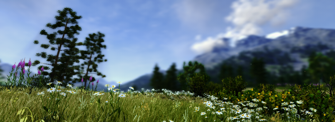
With regard to landscapes, vegetation is still not an issue – neither for Google nor for Microsoft. How about the automatic extraction of vegetation information from photos? There is a lot research about the recognition of vegetation in orthophotos – how about linking this to the automatic population of virtual landscapes with realistic plants?
MapViewSVG renamed Mappetizer
The very useful GIS tool MapViewSVG has been renamed “Mappetizer“. According to the developer, the latest version Mappetizes 8.1 additionally has integrated support for OpenStreetMap (OSM) data (example). Yet, we didn´t have the opportunity to test this new functionality but considering our interest in open source solutions and especially geodata under creative common licenses such as OSM, we are curious about testing Mappetizer 8.1 as soon as possible.
Sketchup Update 7.1
Last week, Google released its Sketchup update 7.1. It`s just an update, but it brings some important improvements for planners, urban designers and landscape architects:
1. The performance of LARGE models was improved
2. From my point of view, dynamic components are one of the most promising new features in Sketchup. Unfortunately, the export of dynamic components was still buggy when they were introduced in Sketchup 7.0 and this bug has now been removed. Expect more news on dynamic components on this blog!
3. Import / Export Collada Files: Most game engines, but also Biosphere3D for example, import buildings as Collada files. Before, you needed modelers such as Cinema4D for Collada export but now you can use Sketchup as well.
4. Import / Export KMZ Files: A long missing step forward to the integration of Sketchup and GoogleEarth
For more details on the Sketchup update 7.1, see http://sketchup.google.com/product/newin7.html
Biosphere3D @ Sourceforge
Biosphere3D is now available at Sourceforge:
ArcGIS Explorer

ESRI has released a new version of its digital globe “ArcGIS Explorer”. The new version provides an improved interface; enhanced data support including kml/kmz; the opportunity to switch between 2D and 3D; a new presentation mode with titles, pop-ups, layers etc.; new online data libraries; a SDK for customization and plenty of projections to choose from. With the online data, there is also a direct link to BING maps and if some of you remember my previous article on the co-operation between Microsoft and ESRI, this is probably one of its first outcomes.
In the times of GoogleEarth, where is the niche for ArcGIS Explorer? Well, there are some good reasons, why ArcGIS Explorer might be worth a consideration for landscape planners: First, most of us are already working with ArcGIS and the workflow is easier than it is between ArcGIS and GoogleEarth, where you need CommunityViz or other plugins. Particularly, you can add plenty of geodata formats and your own DEM which is not possible in GoogleEarth. Then, the presentation mode is neat for planners who present to the public. And finally, the possibilities to choose a specific projection or even to customize your interface may meet expert needs that GoogleEarth cannot satisfy.
Major Bing Maps Update
41TB of new imagery, vector data etc… The following URL will start a tour through some of the updated locations: http://bingmapsupdates.cloudapp.net
Siggraph 2009
Currently, SIGGRAPH 2009 takes place and many visualization companies show their latest product versions. Autodesk focussed mainly on Maya, no news from LandXplorer here. However, they are currently working on a complete re-programming of the promising geobrowser, so that might still take a while.
Always interesting for landscape visualization is E-on’s software Vue (see the previous post on Vue 7) which will be released as Vue 8 until the end of the year. The new version will support 3D terrain modelling and even more advanced atmospheric models for haze and clouds. The image shows a recent test rendering in Cinema 11 with trees, wave and atmosphere model from the Vue 7 plugin for Cinema.

Google Earth API: Embeddable KML w/o JavaScript
At the Google I/O 2009 new features of the Google API were introduced:
http://www.youtube.com/watch?v=H7fxHp7oHcI
Among others, the GoogleEarth Plugin was further developed. With this plugin, you can embed GoogleEarth contents in normal websites. With the help of the following Google Gadget, this is now pretty simple: http://tr.im/embedkml.
For the following very simple example, I used an overview of Canadian Universities. However, I also tried this technique with very large and complex kml files and it worked as well. The Google developer forum gives more information which features of GoogleEarth are included already and which are not.