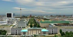
3D city database for CityGML released

Virtual 3D city models are getting more complex, detailed, and increasingly large. Therefore, good solutions for the storage and the management of 3D city models are needed. Within this context we want to inform you that there is now a 3D database schema for the storage and management of CityGML-based 3D city models freely available, which can be implemented on top of Oracle 10G/11G. It also works with the Express version of both databases, which is free for use for educational and research purposes. The following is a rough translation of the German press release.

Press release, 27th April 2009.

The departement for Geodesy and Geoinformation Science, Berlin Institute of Technology, German has realesed free software tools for the management and storage of CityGML-based virtual 3D city models. The tools include a 3D database schema for the use with Oracle 10G R2 or 11G, an Importer/Exporter, and a Java class library for facilitating the work with CityGML. The package is released under the Lesser GNU Public License v3 and can be downloaded under the following URL: www.igg.tu-berlin.de/software. An English documentation is also available.

The CityGML-based 3D database was developed during the creation of the official 3D city model of Berlin and is successfully used for the storage and management of the city-wide virtual 3D city model. More information about the city model of Berlin as well as a Google Earth enabled version can be found under: www.virtual-berlin.de.

ArcGIS 9.3.1: Partnership between ESRI and Microsoft

In their latest preview of ArcGIS 9.3.1, ESRI announced their intensified partnership with Microsoft, marrying ArcGIS with VirtualEarth.As we currently test in a series of planning workshops in the Rockies, the combination of GIS for spatial analysis and Virtual Globes for visualization and communication is very powerful. In the near future, I will tell you more about the workflow ArcGIS -> CommunityViz -> GoogleEarth / Biosphere3D, including some first screenshots.

For the forthcoming ArcGIS-VirtualEarth integration, please read the following ESRI press release (source: http://www.esri.com/software/arcgis/arcgisonline/whats_new.html).

What’s New in ArcGIS Online 9.3.1

ArcGIS Online 9.3.1 gives users quick and easy access to a set of foundation services for GIS projects, and provides a platform to discover and share geographic information.

Virtual Earth Now Seamlessly Integrated with ArcGIS

A new agreement between ESRI and Microsoft gives ArcGIS users seamless access to Virtual Earth services. ArcGIS Desktop, ArcGIS Server, and ArcGIS Explorer users will be able to directly connect to Virtual Earth services to enhance their GIS projects.

  • ArcGIS Desktop
    • Free, limited annual allotment for users who are current on maintenance
    • Annual subscription with unlimited transactions available for purchase
  • ArcGIS Explorer
    • Access Virtual Earth and share transactions as part of an existing ArcGIS Desktop license.
    • ArcGIS Explorer users who do not have an ArcGIS Desktop license, can evaluate Virtual Earth at no cost for 90 days.
    • Annual subscription with no transaction limits is available for purchase.
  • ArcGIS Server
    • Built-in 90-day evaluation of Virtual Earth, after which an annual, transaction-based subscription can be purchased

New Location Services

  • World geocoding (available for use with ArcGIS 9.3)
    • Geocoding, batch geocoding, reverse geocoding for North America and Europe
    • World place finding (countries, provinces, cities, landmarks)
  • Routing
    • Point-to-point and optimized routing for North America and Europe
  • Drive Time
    • Calculate drive-time polygon using an input location and drive-time values.

Discover and Share Geographic Information

With ArcGIS Online, users can

  • Search for maps published by ESRI and other users.
  • Upload maps and register online map services.
  • Organize and control access to shared maps.
  • Save Web maps as items for others to share, discover, and use.

Better sharing of layers

  • Layers referencing feature or raster data can be combined into a single layer package that comprises of both the layer file and data.
  • These layer packages can be shared with other users via the new ArcGIS Online sharing capability, through files, or by e-mail.

More information can be found in the VirtualEarth Evangelist Blog (no guarantee for the objectivity or correctness for links to third-party blogs)

CityScape 1.6 by PixelActive

A workmate has drawn my attention to a new tool for constructing 3d city models: CityScape 1.6 by PixelActive. Although I had no time to try the demo yet, it seems to me that the included models fit best for cities in Norther America. The supported file formats include elevation data and Collada, which makes it interesting for city planners, too. Another interesting feature is the real-time animation. However, my guess is that it is most useful for game designers.

Open Source Toolkit for 3D Plant Modelling

Yesterday I came across an articel in Graphical Models (71), pp. 1-21. It is about PlantGL, an open-source graphic toolkit for the creation, simulation and analysis of 3D virtual plants. The software is based on three components: a geometric, an algorithmic and a GUI library with an interface to Phyton, which enables a modeller to develop scripts and procedures in Python. Furthermore, importers and exporters for data exchange with several modelling and visualization systems, such as AMAPmod/VPlants and Pov-Ray, exist. The approach combines several methods to represent plant structures at different scales, ranging from tissues to plant communities. One of the features are parametric envelopes for the representation of crown shapes, which sounds to be a very promising technique to control the shape of 3D plant models. Accurate representation of the crown shape will be important for representing plants in real world models (e.g. 3D city models) for visibility analysis.

According to the paper the librarys seem to be very powerful and several examples are presented reaching from 2D and 3D tissue models to branching systems and plant communities. Moreover, a quick overview over current plant modelling approaches is given including L-Studio/Vlab and GroGra based on L-systems, the AMAP system, and Xfrog and extensive references to related work are given. Thus I like to encourage everybody interested in plant and vegetation modelling to read the paper and look at the website of the Virtual Plant project team. The site shows several examples, links to research papers and software, and explains the methods apllied in the research.

Doug Eberhard (Autodesk) promoting CityGML

Last week, I had the chance to see Doug Eberhard, Senior Director of Autocad and head of the Digital Cities Initiative, speaking at the conference “The new dimension in GIS – 3D Analysis“, hosted by the British Columbia section of URISA. His focus were 3D city models and he promoted their future not only for visualization but also for analysis. According to him, the process and people behind need to catch up with the technology, i.e., processes and methods are needed for a collaborative workflow. All these issues are explored in the Digital Cities case studies with Seoul and Salzburg being the first two.

Interestingly, Mr. Eberhard showed lots of examples from LandXplorer (though without mentioning the name of the product) and gave a lot of credits “to the Germans”. Furthermore, he highlighted that CityGML and its interface ADE allow to incorporate extensions for analyses and that has huge potential from his point of view.

LandXplorer screenshort of Berlin (source: http://www.3dgeo.de)

Apparently, Autocad is promoting LandXplorer and CityGML now, which I find very encouraging. You can download an abstract of Mr. Eberhard’s talk at http://www.urisabc.org/assets/events/2009/3D/bios_abstracts/digitalcities.htm and if you like to see another presentation by Doug Eberhard, he will be at AGIT (Salzburg) as well as Geoweb (Vancouver).

GoogleEarth 5.0: 20000 Miles Under The Sea

The new version of GoogleEarth, which can be downloaded now, has been extended by the underwater landscape of the Earth – which is two third of the Earth’s surface… Furthermore, the function for setting up your own tours has been improved and the time-travel function has become standard. Now, it will be really interesting to use GoogleEarth to show landscape development over time, historic and into the future. Oh, and finally, they added the Mars. For a more detailed summary of the new functions in German, see the Der Google Produkt-Kompass: Reise unter die Meeresoberfläche mit Google Earth 5.0 or Youtube (English):

Vue 7 by e-on software released

E-on software has released a new version of their landscape modelling and visualization software vue. According to the offical feature list a number of key methods and technologies have been improved significantly. Amongst the features are ecosystem models, volumetric clouds, tree generation, global ilumination, etc.

A look inside their gallery shows some very detailed and realistic scenes, e.g. the Picture of the Day, Wednesday, December 10, 2008.

Jungle by Maciek Sikora
"Jungle" by Maciek Sikora

I have made some tests with an earlier Version in 2004 and I have to say that it was a lot of fun to work with vue. The main problem was to integrate GIS data and to create realisitc plant distributions. I wonder if this has changed by now, because the visual quality which can be achieved is very impressive.

Sketchup 7 is out now

According to Google, the new publisher of Sketchup, version 7 is out now (Source: Official Google Blog). Among the various new features, the possiblity to assign dynamic behaviour and attributes (only the Pro version) seems particularly interesting to me. In consequence, the construction of semantic models with Sketchup is getting another step closer.

Autodesk buys 3D Geo (LandXplorer)

In August Autodesk already published a press release, announcing that they buy the German company 3D Geo, a spin-off of the Hasso-Plattner Institute in Potsdam that became well-known for their LandXplorer software. LandXplorer is basically an authoring system for 3D geodata that allows to construct, analyze, store and manage 3D city models for various export formats (GeoBrowser, VirtualReality, GameEngines, WebApplications). Among other features, LandXplorer is one of the first software packages to support CityGML. The full text is available at http://www.3dgeo.de/news.aspx?Article=143

Autodesk said that they will keep the office in Potsdam as future development center in Europe and that they will further develop LandXplorer. This might even open a chance that LandXplorer will become a meta-platform to link single Building Information Models on a larger scale, i.e., as part of a semantic 3D city model.

Biosphere3D.org online

Biosphere3D is a 64 bit Windows, real-time, open source landscape visualization system.  The virtual globe is focussing on real-time rendering and visual simulation of vegetation and landscape scenery.  The website has been launched to support the community of programmers and users.

http://www.biosphere3d.org