OpenStreetMap (OSM) project founder Steve Coast has announced that he has joined Microsoft to work on its Bing Maps team. According to Coast, Microsoft will be providing access to its “global orthorectified aerial imagery to help OpenStreetMappers make the map even better than it already is”.
Author: Philip Paar
Autodesk// Labs_ Project VASARI – Conceptual design and analysis for buildings
Download and check out this technology preview:
“Autodesk® Project Vasari is an easy-to-use, expressive design tool for creating building concepts. Vasari goes further, with integrated analysis for energy and carbon, providing design insight where the most important design decisions are made. And, when it’s time to move the design to production, simply bring your Vasari design data into the Autodesk® Revit® platform for BIM, ensuring clear execution of design intent.
Project Vasari is focused on conceptual building design using both geometric and parametric modeling. It supports performance-based design via integrated energy modeling and analysis features. This new technology preview is now available as a free download and trial on Autodesk Labs.”
Sounds like a sort of SketchUp with Add-ons for BIM and analysis. VASARI is based on the Revit framework but with a different GUI.
Stereo multi-touch tabletop interface
Immersion has developed as part of the EU’s V-City project, a collaborative tabletop interface to interact with 3d city environments. The prototype was shown at Siggraph 2010. The multi-view support allows two users to view different viewpoints of the model at the same time from the same 3d mockup.
ESRI ArcGIS + Procedural CityEngine + Nvidia RealityServer
Procedural has joined ESRI’s Business Partner Program. Automatic creation and cloud-based visualization of photorealistic 3D cities from ArcGIS data with CityEngine and RealityServer. Presented on a Tegra Tablet at ESRI User Conference 2010 in San Diego.
IMAGINA 2011 CALL FOR PROJECTS
Conferences: Urbanism & Landscape
Wednesday 2 and Thursday 3 February 2011
Submit a presentation about your experience in 3D for the following themes:
![]() your 3D experience to plan, manage and promote your city or your territory.
your 3D experience to plan, manage and promote your city or your territory.
![]() your adoption of « Geo-referenced » 3D model in the context of your project studies.
your adoption of « Geo-referenced » 3D model in the context of your project studies.
![]() your experience of 3D applied to the preservation of landscape and natural areas.
your experience of 3D applied to the preservation of landscape and natural areas.
Preview ESRI ArcGIS 10: 3D GIS at ArcGIS 10
This video shows some lang to display, analyze, and maintain 3D data in ArcGIS 10. Visit:
New Major Biosphere3D Release

The new release of the free Landscape Scenery Globe Biosphere3D adds rendering effects such as ambient occlusion, shadow mapping and creation of camera paths and capture of animations.

Natural Earth public domain map dataset
Natural Earth is a public domain map dataset available at 1:10m, 1:50m, and 1:110m scales. “Featuring tightly integrated vector and raster data, with Natural Earth you can make a variety of visually pleasing, well-crafted maps with cartography or GIS software.”
Natural Earth Vector comes in ESRI shapefile format, Natural Earth Raster comes in TIFF format with a TFW world file, all Natural Earth data use the Geographic projection, WGS84 datum.
Unfortunately, only zip-File Download and no OGC Web Feature or Web Raster service is provided.
ISPRS Blog – Geographical Visualization and Virtual Reality
Check out or become a member of the new Blog dedicated to Geographical Visualization and Virtual Reality managed by Dr. Christopher J. Pettit (Melbourne) and Dr Andy Hudson-Smith (London) Working Group II/6 of the International Society for Photogrammetry and Remote Sensing (ISPRS): http://www.casa.ucl.ac.uk/geoviz/
You will find several live video recordings of the MODSIM 2009 / ISPRS WGII/6 session on Visualisation in support of management decisions.
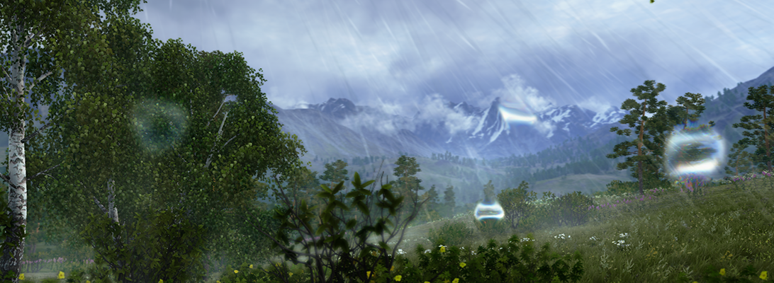
Biomass in Future Landscapes – A Virtual Journey to Landscape Scenery
Biomass in Future Landscapes from Philip Paar on Vimeo.
Fly-throughs are quite popular, especially since the success of Google Earth but what matters more to landscape perception is the human perspective from eye-level view. Lenné3D, a Berlin based corporation, has been invited by the German Biomass Research Centre (DBFZ) to create this visual stunning simulation of future cultural landscape scenarios by virtually implementing biomass into an existing landscape. Our contribution tries to advance the paradigm of Humphrey Repton’s famous before-and-after landscape depictions with dynamic navigation, and to trigger fruitful discussions on the various aspects and issues of biomass in cultural landscapes.
The video animation “Biomass in Future Landscapes” shows both fly-through and walk-troughs and a time travel. New landscape scenery patterns and time and again views arise from implementation of linear structures such as alley-cropping systems.
The video is based on a virtual 3D model derived from geodata such as a digital elevation model and land use maps and field patterns, vegetation relevés, and descriptions of cropping practices. A plant distributor software arranges the vegetation cover. Finally, a virtual camera flies and walks though the 3D landscape model and the animation is rendered using the interactive Lenné3D-Player software.
The video was presented first at the international conference Biomass in Future Landscape, Berlin, March 31st – April 1st 2009.